XPLAY › Fibre and infrastructure › SPOTTER
SPOTTER
Road survey
A few partners per sector: real environment, shared roadmap.
TypeField apps—
FamilyFibre and infrastructureas in the launcher
WherePhonemeasurements in the platform
LanguagesIT · ENinterface and manual
LicenceOn requestper organisation
What it does
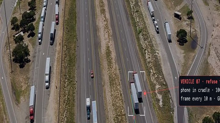
SPOTTER is the road survey app: the phone on the dashboard records the road while the vehicle does its round and sends the survey to XROAD. It is built for vehicles that already travel the network every day, with no dedicated equipment.
Features
- Continuous GPS track, even with the screen off
- Accelerometer shocks recorded along the route
- Video of the road surface recorded in segments
- Automatic upload only on Wi-Fi and while charging, with no duplicates after an interruption
- In XROAD one frame every 10 metres, with people, faces and plates blurred
How to use
- Install SPOTTER and register the phone in the fleet
- Mount the phone on the dashboard and start the survey
- At the end of the round put the phone on charge on Wi-Fi: the survey uploads by itself
- Open XROAD to process the survey
Information
Publisherarimas
Version0.1.0
RequiresATLAS
PermitsRead data
Talk to usParla con noi
Tell us your use case: we'll tell you which XPACKs to switch on and how to start inside NEXT Fusion.Raccontaci il caso d'uso: ti diciamo quali XPACK accendere e come partire dentro NEXT Fusion.