Map Matching: How Raw GPS
Becomes a Usable TrackMap Matching: come il GPS grezzo
diventa una traccia utilizzabile
Every fleet dashboard, every drive test and every delivery app relies on the same fragile input: a stream of GPS positions that is wrong more often than most people think. Map matching is the discipline that turns that noisy stream into the path a vehicle actually took — and the difference between a raw trace and a matched one decides whether your distances, times and coverage attributions can be trusted at all.
Ogni cruscotto di flotta, ogni drive test e ogni app di consegne si affida allo stesso input fragile: un flusso di posizioni GPS che sbaglia più spesso di quanto si creda. Il map matching è la disciplina che trasforma quel flusso rumoroso nel percorso che il veicolo ha davvero seguito — e la differenza fra una traccia grezza e una agganciata decide se distanze, tempi e attribuzioni di copertura siano affidabili o no.
Why GPS LiesPerché il GPS mente
A GNSS receiver computes its position from the travel time of signals emitted by satellites twenty thousand kilometres away. In an open field the result is impressive — a few metres of error. In the environments where fleets actually operate, three effects degrade it badly. Multipath: in dense urban areas the signal bounces off facades before reaching the antenna, and the receiver measures the bounced path, placing the vehicle inside a building or on the wrong side of a boulevard. Canyoning: with satellites visible only in a narrow strip of sky between tall buildings, geometry collapses and the error grows to tens of metres. Outages: in tunnels, garages and under dense canopy there is simply no signal, and the trace stops dead — or worse, resumes with a wild jump.
The damage is not cosmetic. Every metric computed downstream inherits the error: kilometres driven are overestimated by zig-zag noise, stop detection fires in the wrong places, and any measurement attached to the position — a signal reading, a delivery timestamp, a fuel event — is attributed to the wrong stretch of road.
Un ricevitore GNSS calcola la propria posizione dal tempo di volo di segnali emessi da satelliti a ventimila chilometri. In campo aperto il risultato è notevole — pochi metri di errore. Negli ambienti dove le flotte lavorano davvero, tre effetti lo degradano pesantemente. Multipath: nei centri urbani densi il segnale rimbalza sulle facciate prima di raggiungere l'antenna, e il ricevitore misura il percorso rimbalzato, piazzando il veicolo dentro un palazzo o sul lato sbagliato del viale. Canyoning: con i satelliti visibili solo in una striscia stretta di cielo tra edifici alti, la geometria collassa e l'errore cresce a decine di metri. Interruzioni: in galleria, nei garage e sotto chiome fitte il segnale semplicemente non c'è, e la traccia si ferma — o peggio, riparte con un salto selvaggio.
Il danno non è cosmetico. Ogni metrica calcolata a valle eredita l'errore: i chilometri percorsi sono sovrastimati dal rumore a zig-zag, il rilevamento delle soste scatta nei posti sbagliati, e ogni misura attaccata alla posizione — una lettura di segnale, un timestamp di consegna, un evento carburante — viene attribuita al tratto di strada sbagliato.
What Map Matching IsCos'è il Map Matching
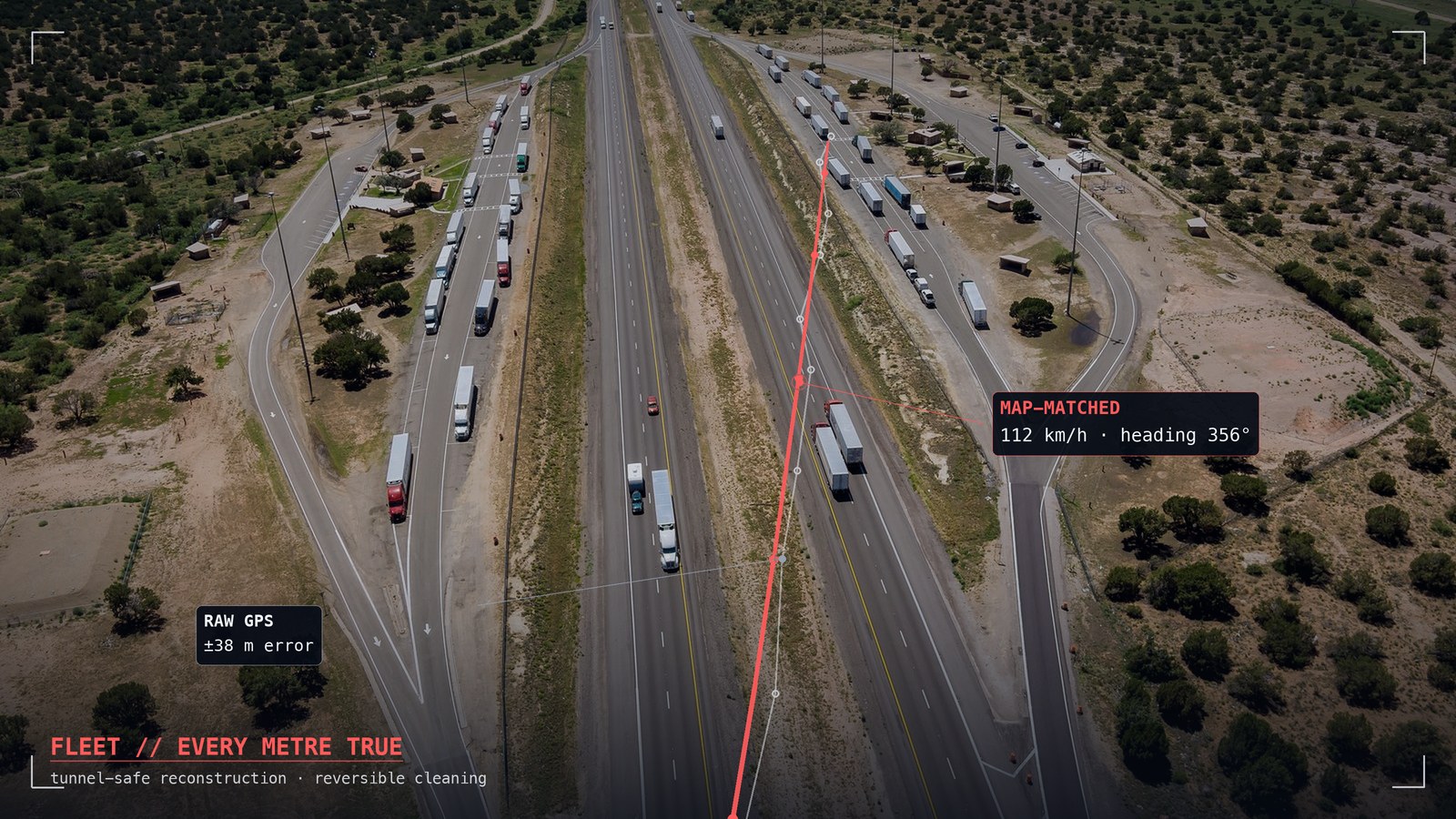
Map matching is the process of projecting a sequence of noisy positions onto a road graph — the network of street segments and their connectivity — to recover the most plausible path. Naive approaches snap each point to the nearest road independently, which fails exactly where it matters: near intersections, parallel streets and overpasses. Modern matchers reason about the sequence: given where the vehicle was and how fast it was moving, which chain of connected road segments best explains all the observations together?
The classic formulation is a Hidden Markov Model: candidate road positions are states, GPS readings are noisy observations, and road connectivity constrains the transitions. The matcher finds the path of maximum likelihood through the graph. The output is not just a prettier line — it is a topologically valid route on which distances are measured along the road, not across rooftops, and every sample acquires a meaningful position: this road, this direction, this kilometre point.
Il map matching è la proiezione di una sequenza di posizioni rumorose su un grafo stradale — la rete dei segmenti e delle loro connessioni — per ricostruire il percorso più plausibile. Gli approcci ingenui agganciano ogni punto alla strada più vicina in modo indipendente, e falliscono proprio dove conta: vicino agli incroci, alle strade parallele e ai cavalcavia. I matcher moderni ragionano sulla sequenza: dato dove il veicolo era e a che velocità si muoveva, quale catena di segmenti connessi spiega meglio tutte le osservazioni insieme?
La formulazione classica è un Hidden Markov Model: le posizioni candidate sulle strade sono gli stati, le letture GPS le osservazioni rumorose, e la connettività stradale vincola le transizioni. Il matcher trova il cammino di massima verosimiglianza attraverso il grafo. Il risultato non è solo una linea più bella — è un percorso topologicamente valido su cui le distanze si misurano lungo la strada, non sopra i tetti, e ogni campione acquisisce una posizione con significato: questa strada, questa direzione, questo chilometro.
The Tunnel ProblemIl problema delle gallerie
Tunnels are the hardest case because there is nothing to match: the receiver is blind for seconds or minutes. Yet the vehicle did not teleport — it followed the tunnel. A good reconstruction bridges the outage using the road graph (the tunnel has a known geometry), the entry and exit fixes, and whatever dead-reckoning signals are available: speed, heading, accelerometer. The reconstructed segment should be explicitly marked as inferred, not measured — an honest platform never disguises interpolation as observation.
A subtle trap, known to anyone who has built one of these systems: if the matcher advances at the speed the filter believes rather than the speed the vehicle travels, the reconstructed path lags reality and coverage gets attributed to the wrong kilometres. Getting tunnels right is a discriminating test for any tracking product.
Le gallerie sono il caso più difficile perché non c'è nulla da agganciare: il ricevitore è cieco per secondi o minuti. Eppure il veicolo non si è teletrasportato — ha seguito la galleria. Una buona ricostruzione colma l'interruzione usando il grafo stradale (la galleria ha una geometria nota), i fix di ingresso e uscita, e i segnali di navigazione stimata disponibili: velocità, direzione, accelerometro. Il tratto ricostruito va marcato esplicitamente come inferito, non misurato — una piattaforma onesta non traveste mai l'interpolazione da osservazione.
Una trappola sottile, nota a chiunque abbia costruito uno di questi sistemi: se il matcher avanza alla velocità in cui il filtro crede invece che a quella a cui il veicolo viaggia, il percorso ricostruito resta indietro rispetto alla realtà e la copertura viene attribuita ai chilometri sbagliati. Fare bene le gallerie è un test discriminante per qualsiasi prodotto di tracking.
What to Demand from a PlatformCosa pretendere da una piattaforma
- Reversibility. Corrections must never destroy the original samples. If the matcher got it wrong, you need the raw data to do better.
- Honest provenance. Measured, matched and inferred points must be distinguishable — visually and in the data model.
- Tunnel handling. Ask specifically how outages are reconstructed, and at what speed the bridge advances.
- Privacy by design. A track is personal data the moment it is tied to a person. Attribution should pass through a separately protected registry, not live inside every sample.
- Reversibilità. Le correzioni non devono mai distruggere i campioni originali. Se il matcher ha sbagliato, servono i dati grezzi per fare meglio.
- Provenienza onesta. Punti misurati, agganciati e inferiti devono essere distinguibili — visivamente e nel modello dati.
- Gestione delle gallerie. Chiedi esplicitamente come vengono ricostruite le interruzioni, e a che velocità avanza il ponte.
- Privacy per costruzione. Una traccia è un dato personale nel momento in cui è legata a una persona. L'attribuzione deve passare da un registro protetto separatamente, non vivere dentro ogni campione.
Map Matching in NEXT FusionIl Map Matching in NEXT Fusion
NEXT Fusion applies everything above as running code: positions are snapped to the road graph, tunnel gaps are reconstructed at the vehicle's dead-reckoning speed, corrections are reversible, and the original points are preserved forever. Measurements are stored without personal identifiers — device labelling passes through the fleet registry. It is the difference between plotting dots and knowing where your fleet actually went.
NEXT Fusion applica tutto quanto sopra come codice in esecuzione: le posizioni si agganciano al grafo stradale, i buchi in galleria si ricostruiscono alla velocità stimata del veicolo, le correzioni sono reversibili e i punti originali restano conservati per sempre. Le misure sono archiviate senza identificativi personali — l'etichettatura passa dal registro flotta. È la differenza fra disegnare puntini e sapere dove la tua flotta è passata davvero.
Tunnel-safeTunnel-safe
Outages bridged on the road graph at real vehicle speed.Interruzioni colmate sul grafo stradale alla velocità reale del veicolo.
ReversibleReversibile
Originals always preserved — every correction can be undone.Originali sempre conservati — ogni correzione si può annullare.
GDPR-readyPronto GDPR
No personal identifiers in the samples, by design.Nessun identificativo personale nei campioni, per costruzione.